droid Help

  • The tabs at the top are used to select which type of conversion you would like to perform.
  • LSD denotes Dominion Land Survey Coordinates which comprise of Legal Subdivisions, Townships, Ranges and Meridians.
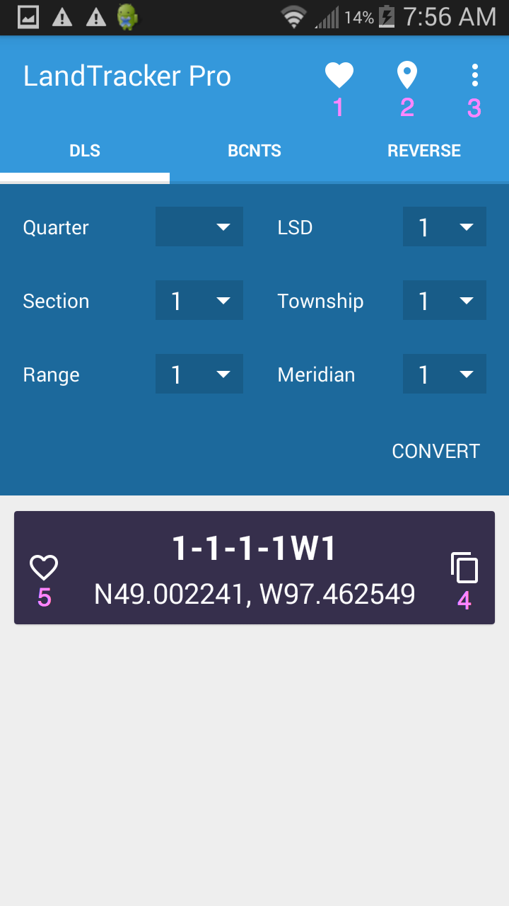
    • To Enter an LSD simply select each field and select the corresponding entry. When you are done select the convert button.

    • If you wish to select a Quarter Section Simply select the Quarter and it will automatically change the LSD to the value of 1

  • Once you have selected the convert button you are provided with the latitude and longitude coordinate corresponding to the LSD.
  • To save the coordinate for future use as a favourite please select the Heart Icon (5) next to the coordinates that were converted. You also have the option of copying the coordinate to the clipbopard by pressing the copy button (4)
    • To view a list of your favourites select the heart button (1) at the top of the screen.

  • To show the coordinate in Google Maps simply click on the map icon (2) located at the top of the screen. This will launch Google Maps on your browser and will display the coordinate as a push pin. If you have loaded other Navigation Apps such as Map Quest, the program will ask you which program you would like to use. Bear in mind that it will not necessarily work with all the navigation apps you are using but it works with MapQuest flawlessly and its a free app. If you are having issues with displaying the coordinate in Google Maps try and deactivating "Export Labels" in the Settings dialog. This can be reached by pressing the settings button (3).
  • So lets assume you are using Google Maps and you get the following screen.
  • To get directions to the pushpin from your current location simply click on the Directions button.
  • Once you have clicked on the directions button the next screen will ask you if you want to navigate to the location or simply get driving directions to the location. Simply click the button to navigate.
  • Accept the navigation terms below.
  • This will provide a route to the well location.


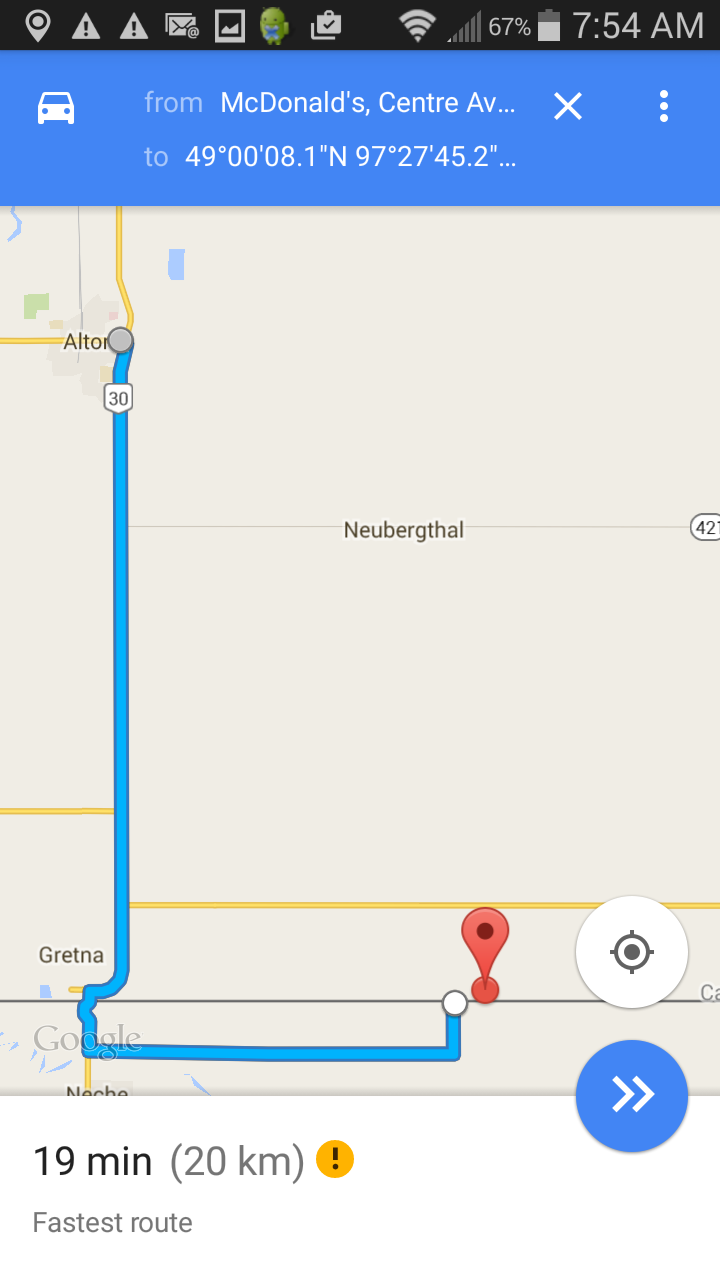
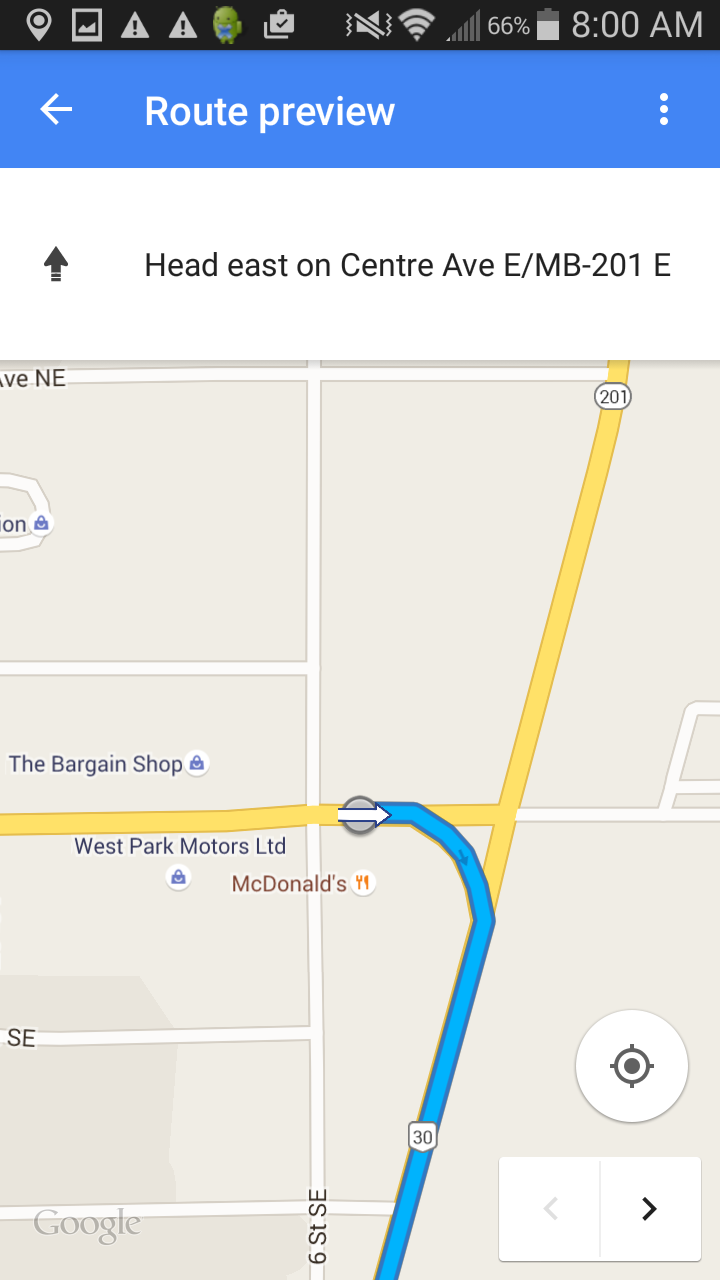
You can now follow the outlined route with your device:

For the BC NTS Coordiantes its the same procedure as above except you select the BCNTS tab.

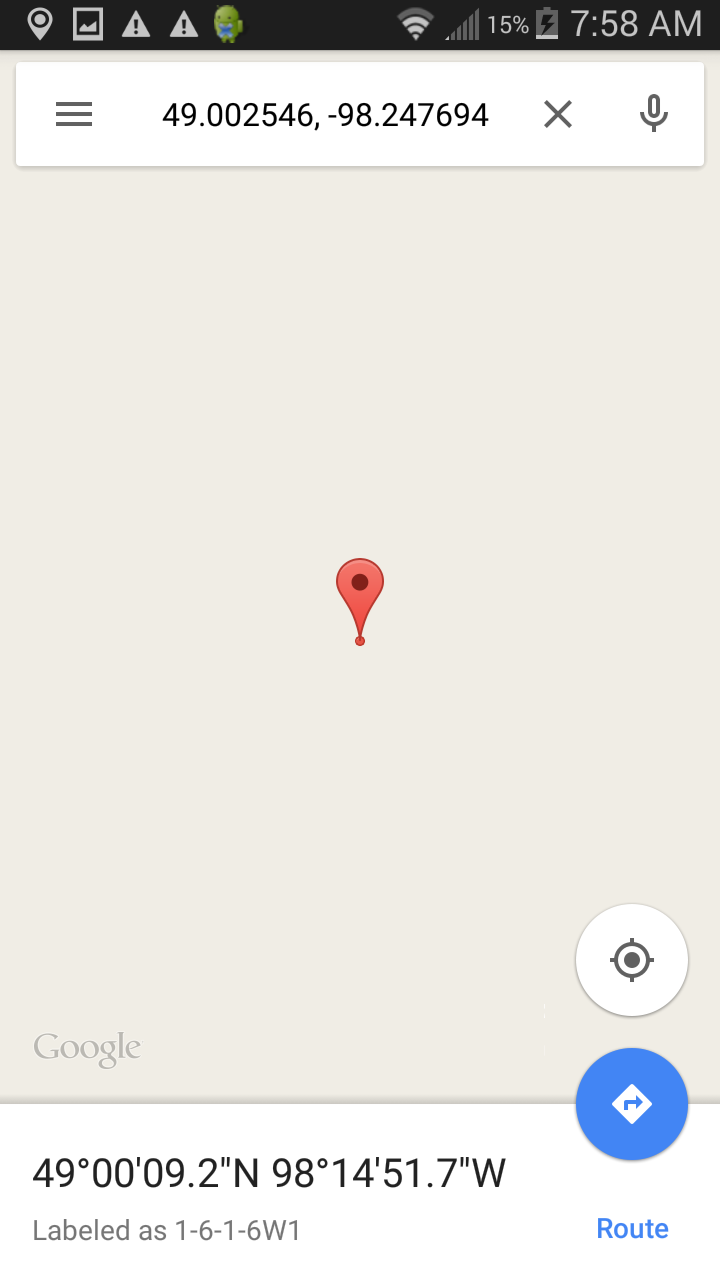
For the Reverse converter simply press the "Get Current Location" button and then press "Convert". If you are having problems getting a lat/long then go into the settings dialog by pressing the settings button (3) and disable "Use detailed location". This should resolve the issue.